1919 Kenyon ' S Highway Census Pocket Map Of Michigan Auto Trails & East Wisconsin


Item History & Price

Information:
Reference Number: Avaluer:10143Cartographer/Publisher: Kenyon
Type: Pocket mapPrinting Technique: Lithography
Year: 1925Original/Reproduction: Original
US State: WisconsinCountry/Region of Manufacture: United States
Date Range: 1919Topic: Maps
City: multiFormat: map
Country/Region: Michigan
Original Description:
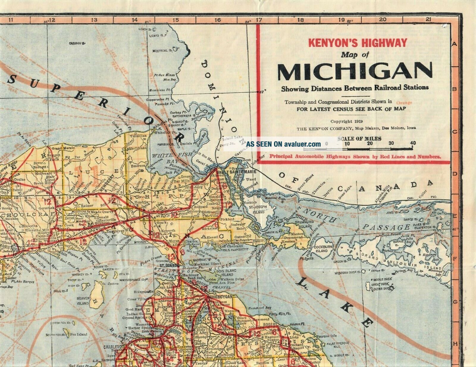
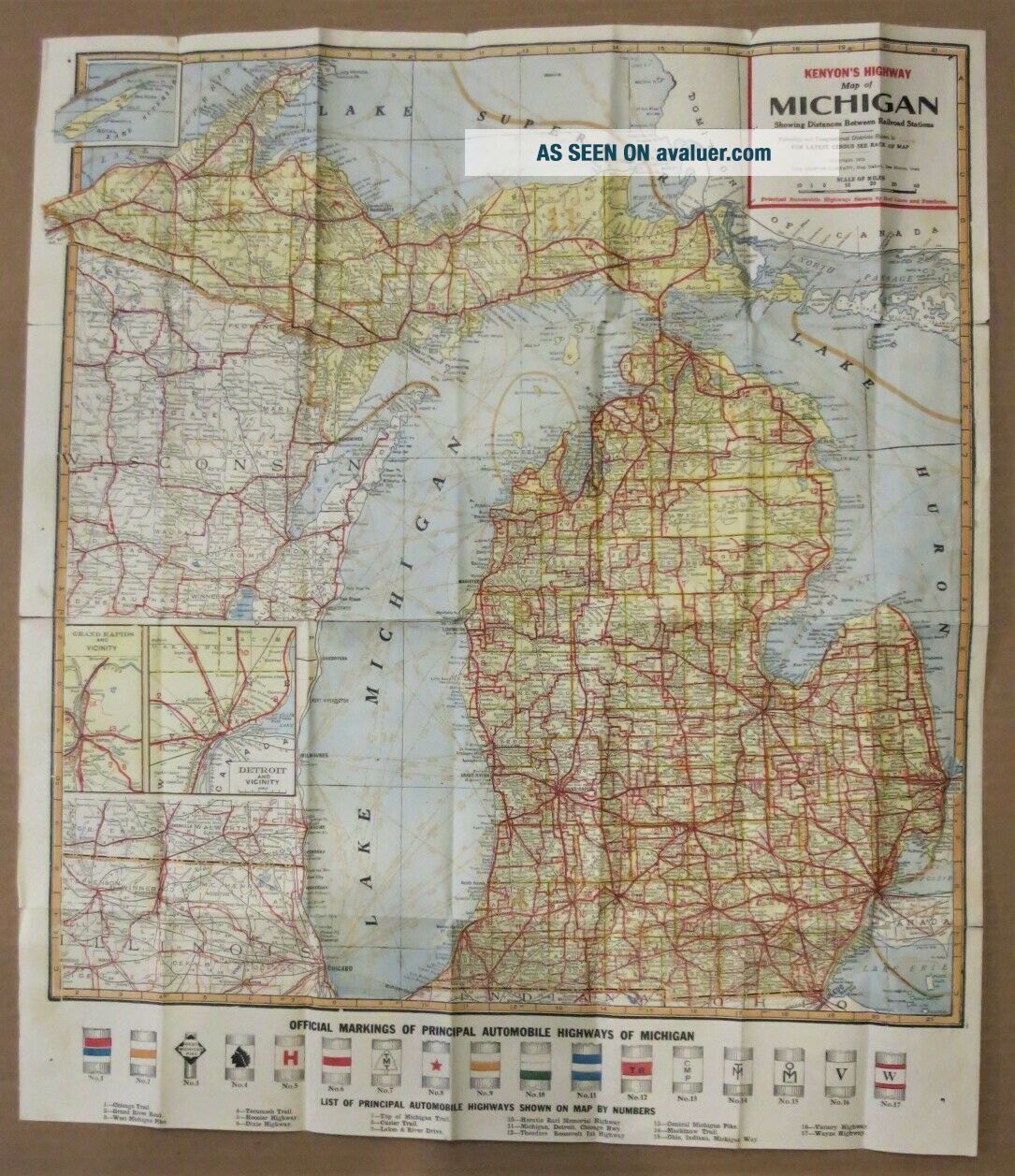
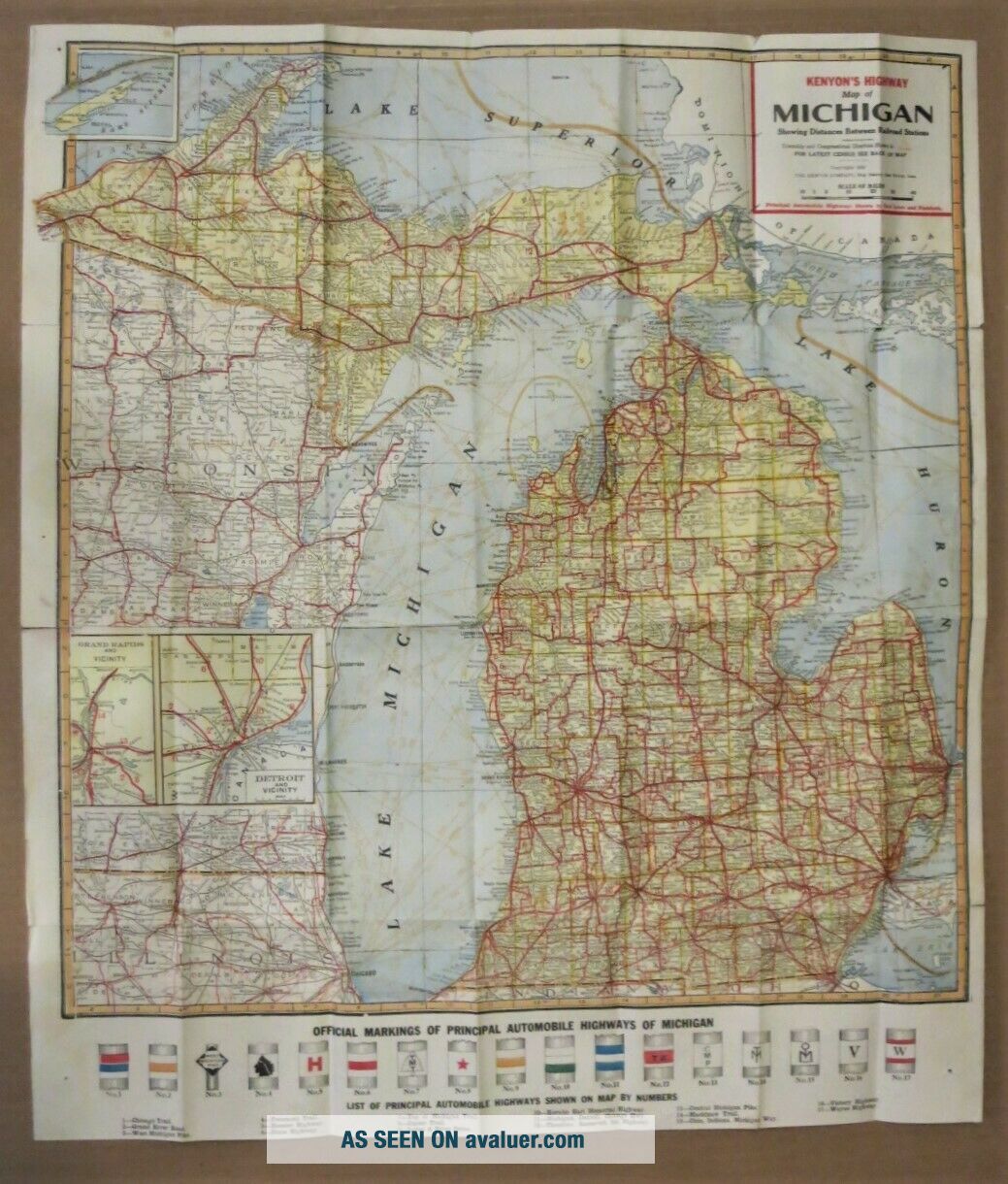
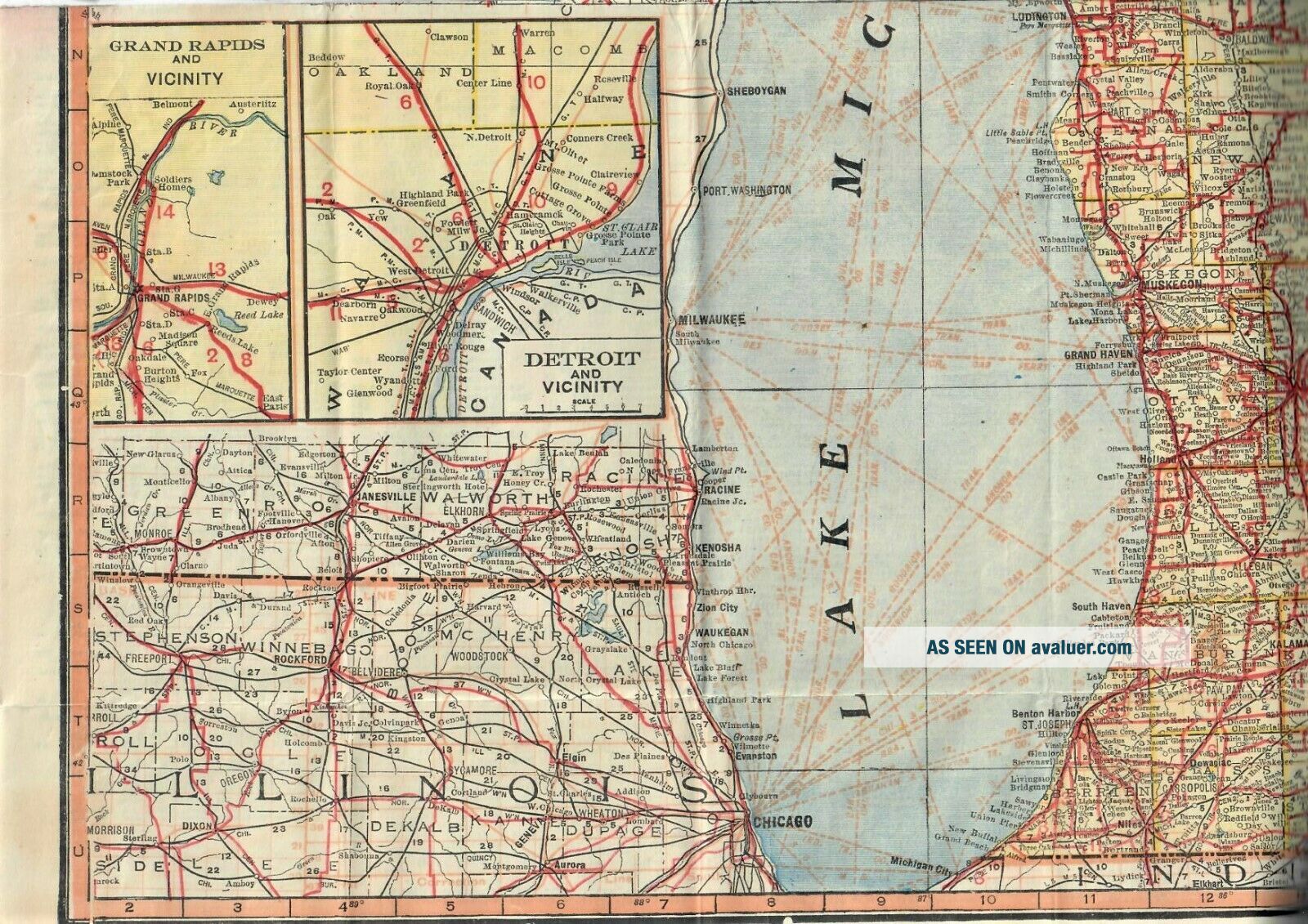
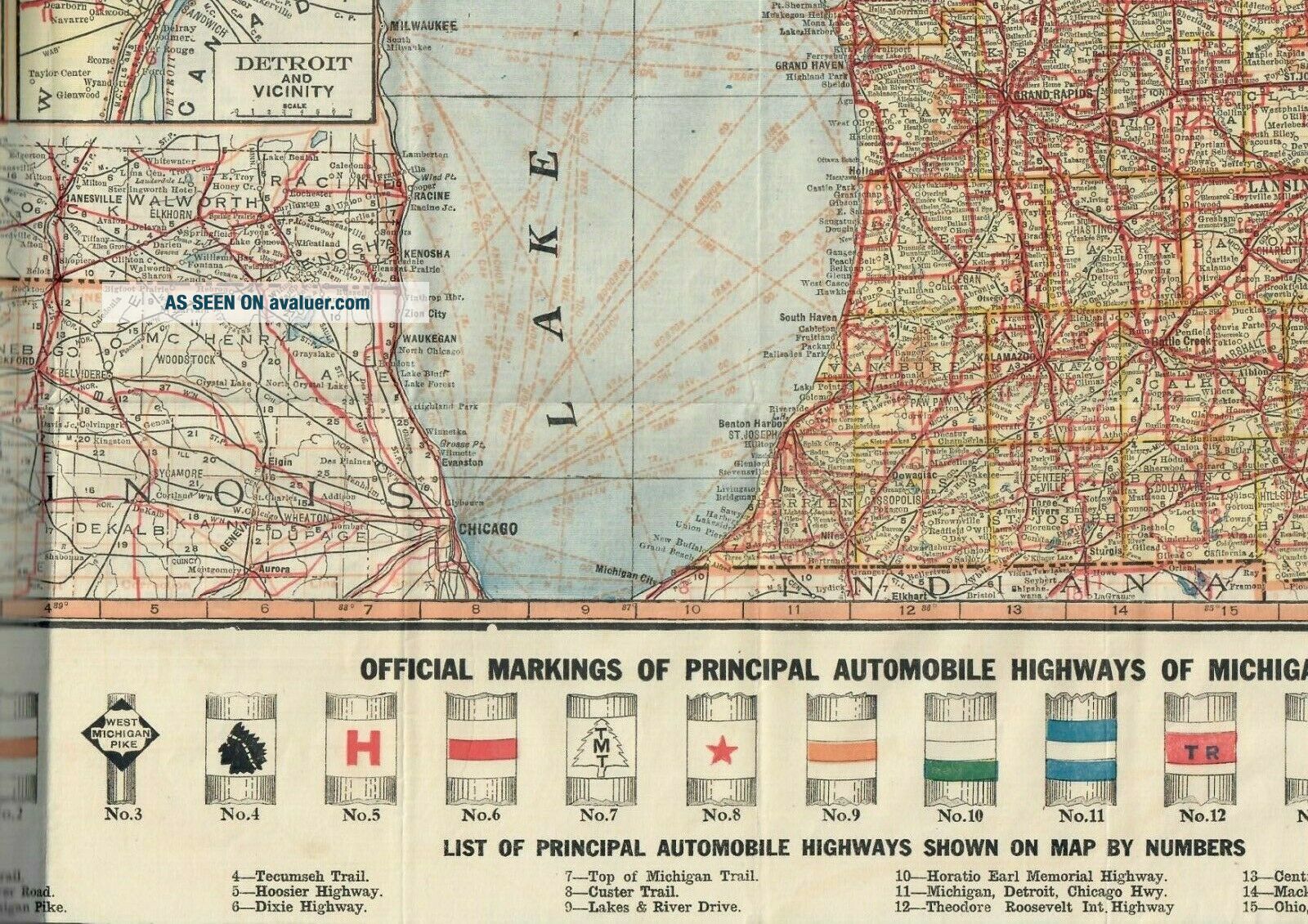
1919 Kenyon 's Double Sided Auto Road Map of Michigan # b       Great early vintage folding map.Would look great framed.
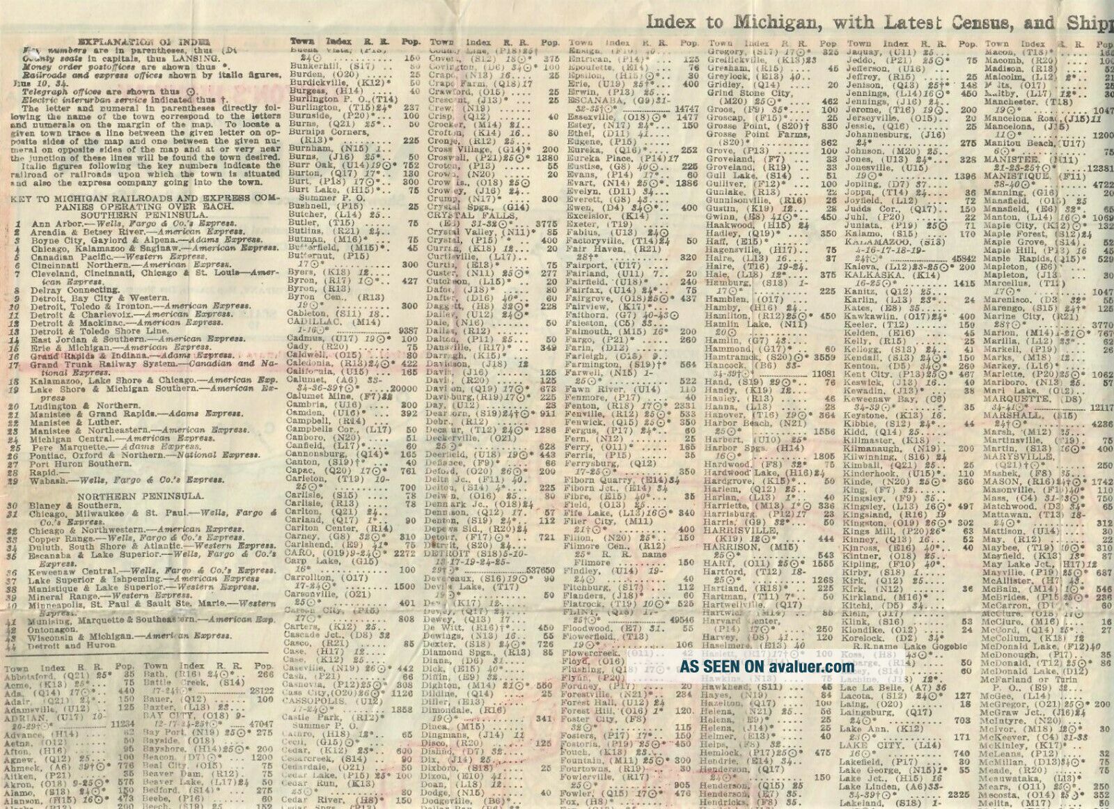
One side shows the state of Michigan with some inset maps of the Detroit and Grand Rapids vicinities  (and some portions of the surrounding States, and Canada)  and the other side has an index to  Michigan with Census and Postal Guide.  Measures about 3.25" x 6.25 inches when closed and folds out to about 20.5" x 23.5"
Th...is is a great item for the vintage road map collector.
mf


    Similar items


  • Rare Unusual Antique 1851 Haskell

    Rare Unusual Antique 1851 Haskell ' S Vtg Folding Pocket Map Canton Fulton County

  • Vintage 353 Germany Cram

    Vintage 353 Germany Cram ' S Modern Series Pocket Map

  • Aaa Route 66 Guide Series America

    Aaa Route 66 Guide Series America ' S Highway Travel Road Map Hackberry Az Cover

  • U S Highway 212 Brochure Map St Paul & Minneapolis To Billings Yellowstone

    U S Highway 212 Brochure Map St Paul & Minneapolis To Billings Yellowstone

  • 1950

    1950 ' S Highway 287 Promotional Map Brochure

  • Vintage 1946 Cram

    Vintage 1946 Cram ' S Modern Series Pocket Map Of Europe

  • 70 Vintage U.  S.  Highway City Transit Maps Mobil Sohio Atlantic $9.  95

    70 Vintage U. S. Highway City Transit Maps Mobil Sohio Atlantic $9. 95

  • Antique Sterling Silver 1919 Kay

    Antique Sterling Silver 1919 Kay ' S Special Worcester Pocket Watch Dennison Case.


    • You might also like


    • 1860 Mitchell Hand Colored Map Colorado,  Nebraska & Kansas - Civil War Era

      1860 Mitchell Hand Colored Map Colorado, Nebraska & Kansas - Civil War Era

    • 18th Century French Map Of North America

      18th Century French Map Of North America

    • Las Vegas Nevada Vintage 1967 Us Geological Survey Quadrangle Map 4 Panels

      Las Vegas Nevada Vintage 1967 Us Geological Survey Quadrangle Map 4 Panels

    • Rare Antique 1845 Maps United States Exploring Expedition Book Antartica Hawaii

      Rare Antique 1845 Maps United States Exploring Expedition Book Antartica Hawaii

    • Vintage 1926 Map Hollywood From The Best Surveys Of The Time

      Vintage 1926 Map Hollywood From The Best Surveys Of The Time

    • American Continent (western Hemisphere) 1747 Bowen Antique Copper Engraved Map

      American Continent (western Hemisphere) 1747 Bowen Antique Copper Engraved Map

    • Gulf Coast Florida Texas United States 1705 De Fer Unusual Antique Engraved Map

      Gulf Coast Florida Texas United States 1705 De Fer Unusual Antique Engraved Map

    • California As Island United States 1700 De Fer Unusual First Edition Antique Map

      California As Island United States 1700 De Fer Unusual First Edition Antique Map

Avaluer          About Us          Privacy Policy          Contact Us          UP
© 2022, avaluer.net, Inc. or its affiliates