Rare 1834 Samuel Augustus Mitchell Maine Hampshire Vermont Pocket Map Framed


Item History & Price

Information:
Reference Number: Avaluer:11513Cartographer/Publisher: Samuel Augustus Mitchell
Year: 1834Printing Technique: Copper Plate
US State: CT, MA, ME, NH, RI, VTOriginal/Reproduction: Antique Original
Date Range: 1800-1899Format: Folding Map
Country/Region: United States of AmericaType: Gazetteer
Original Description:
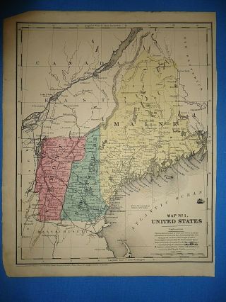
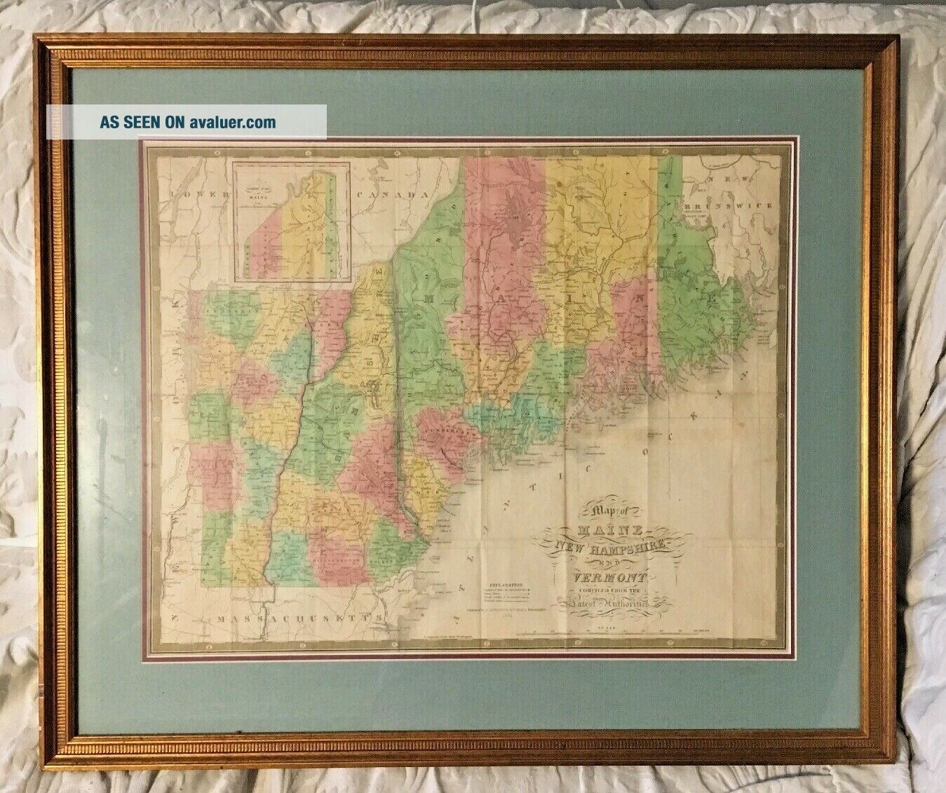
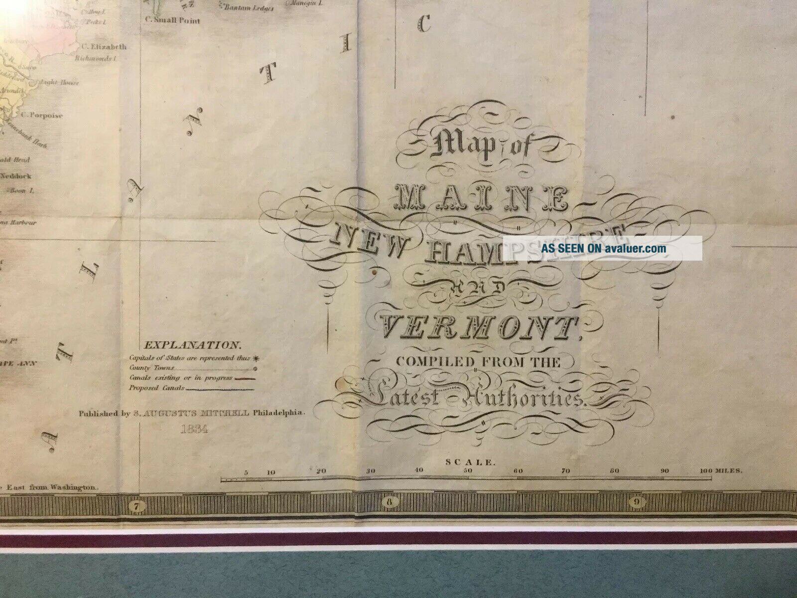
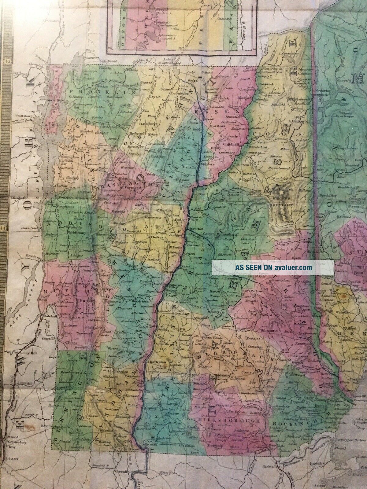
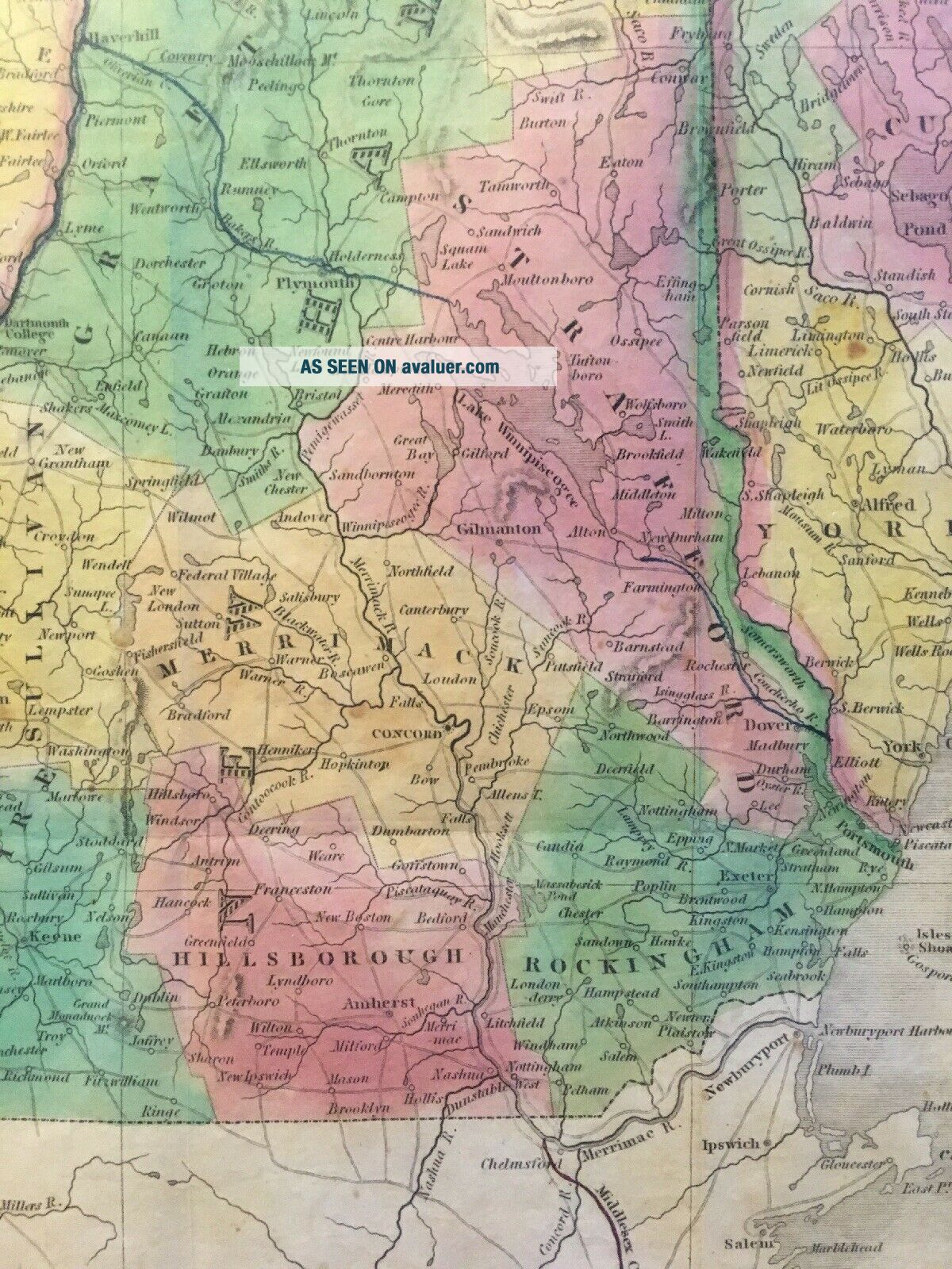
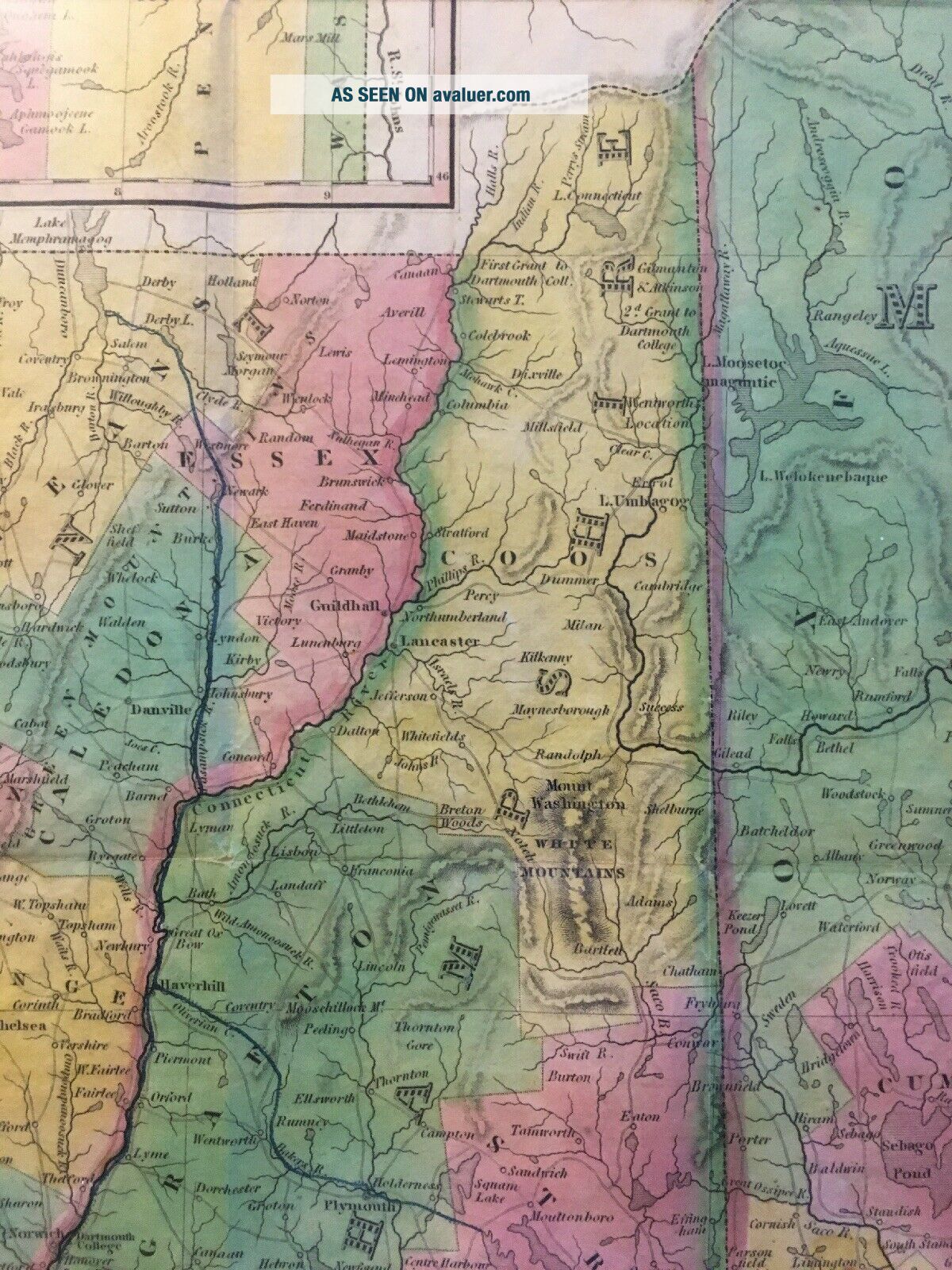
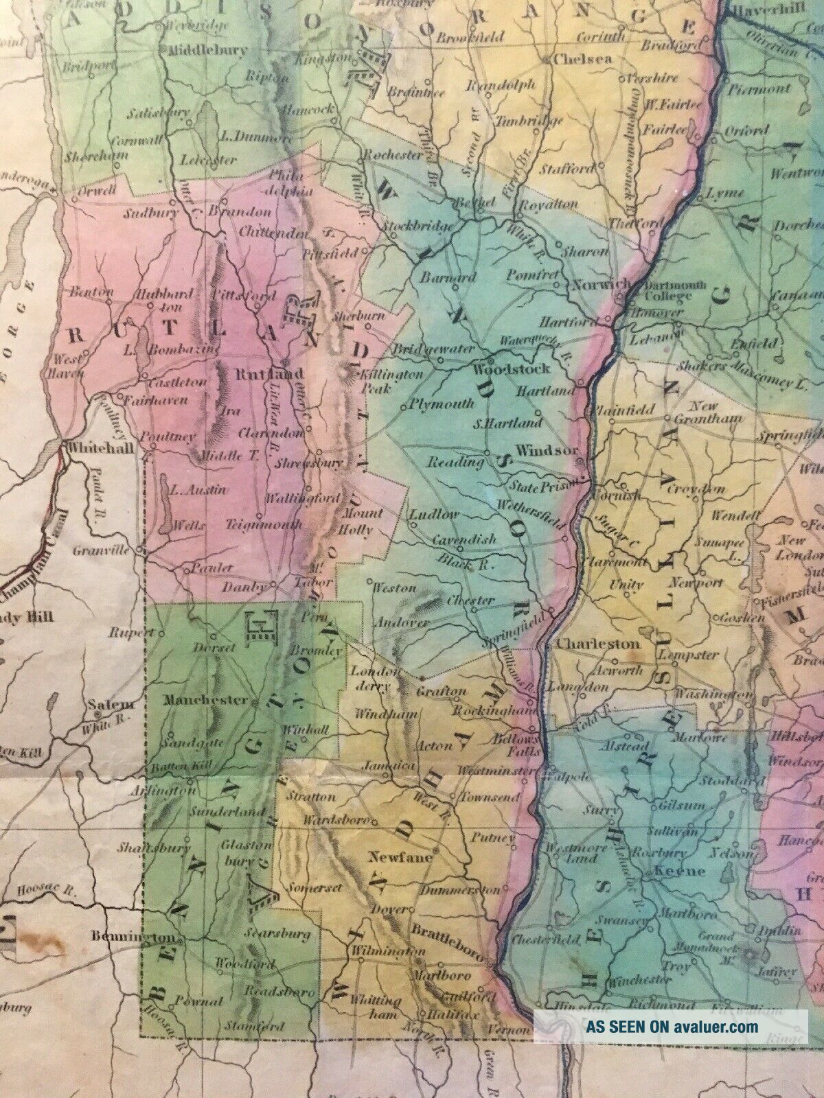
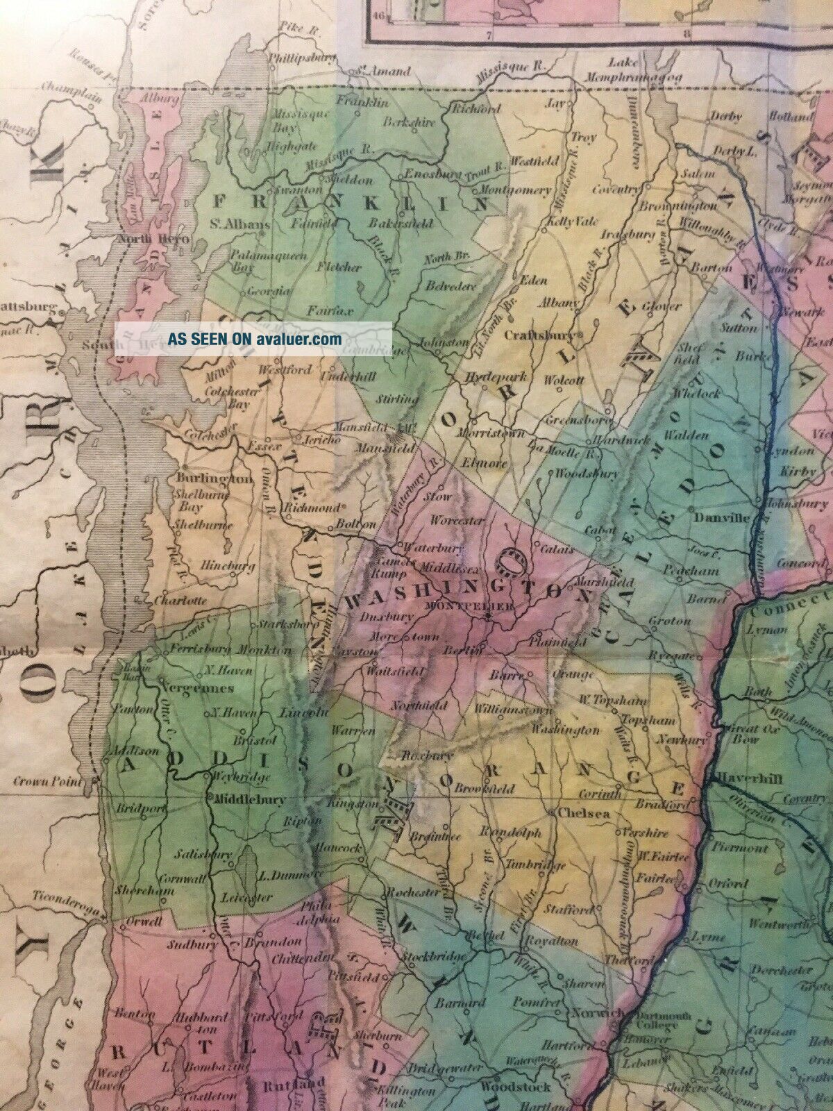
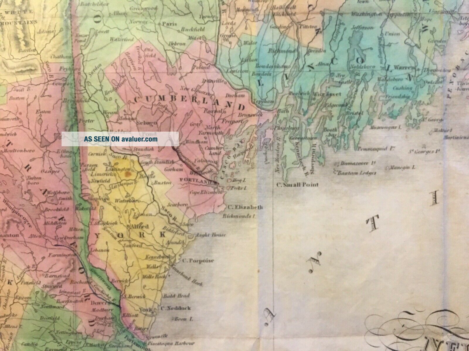
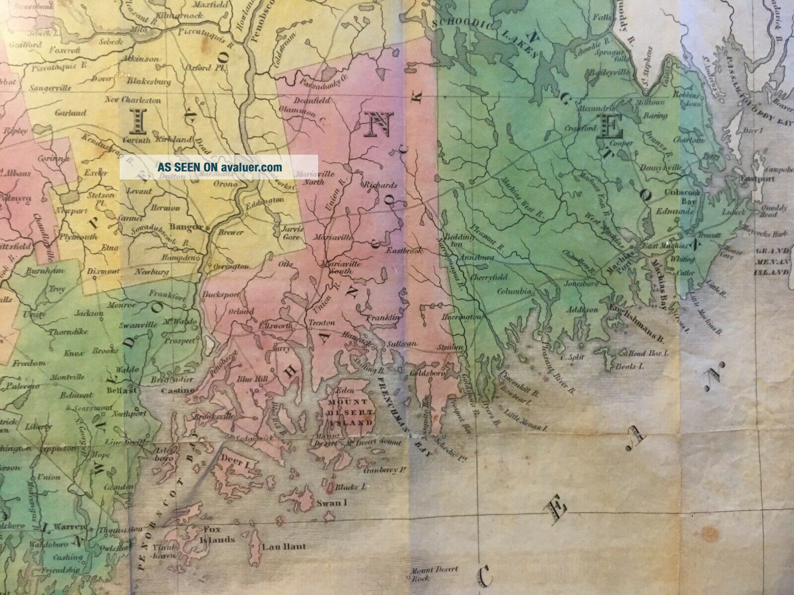
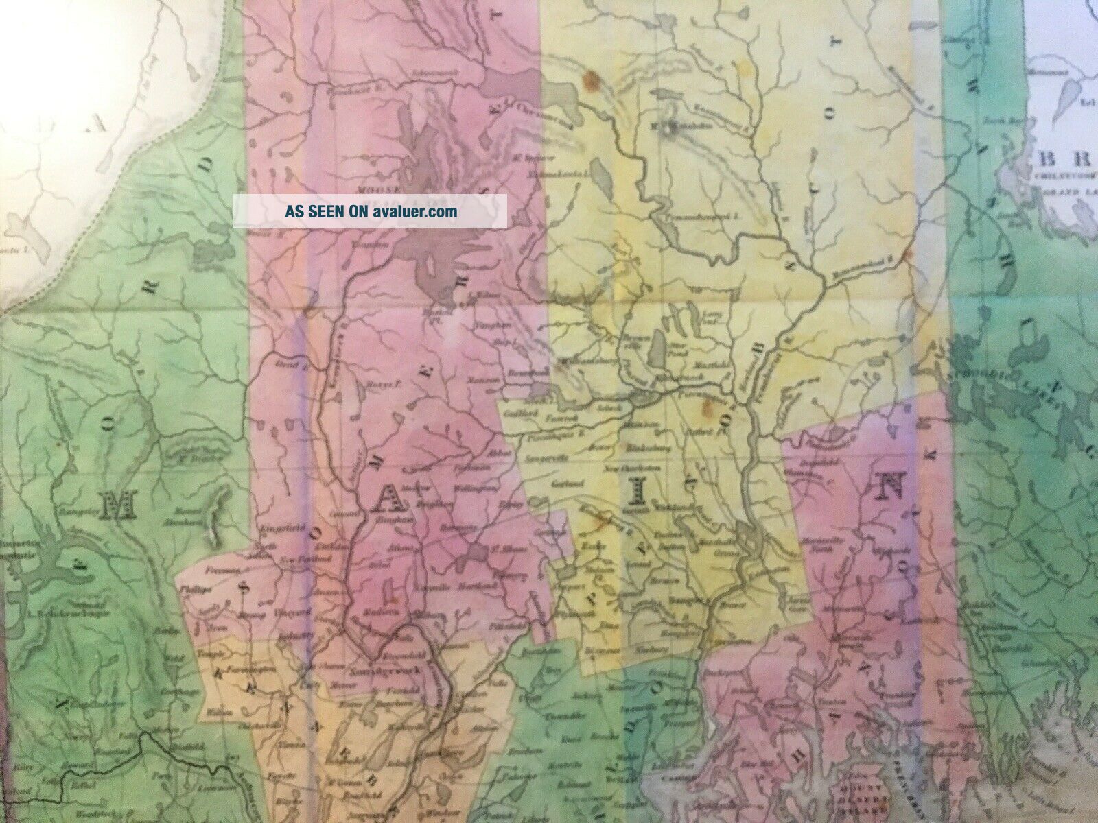
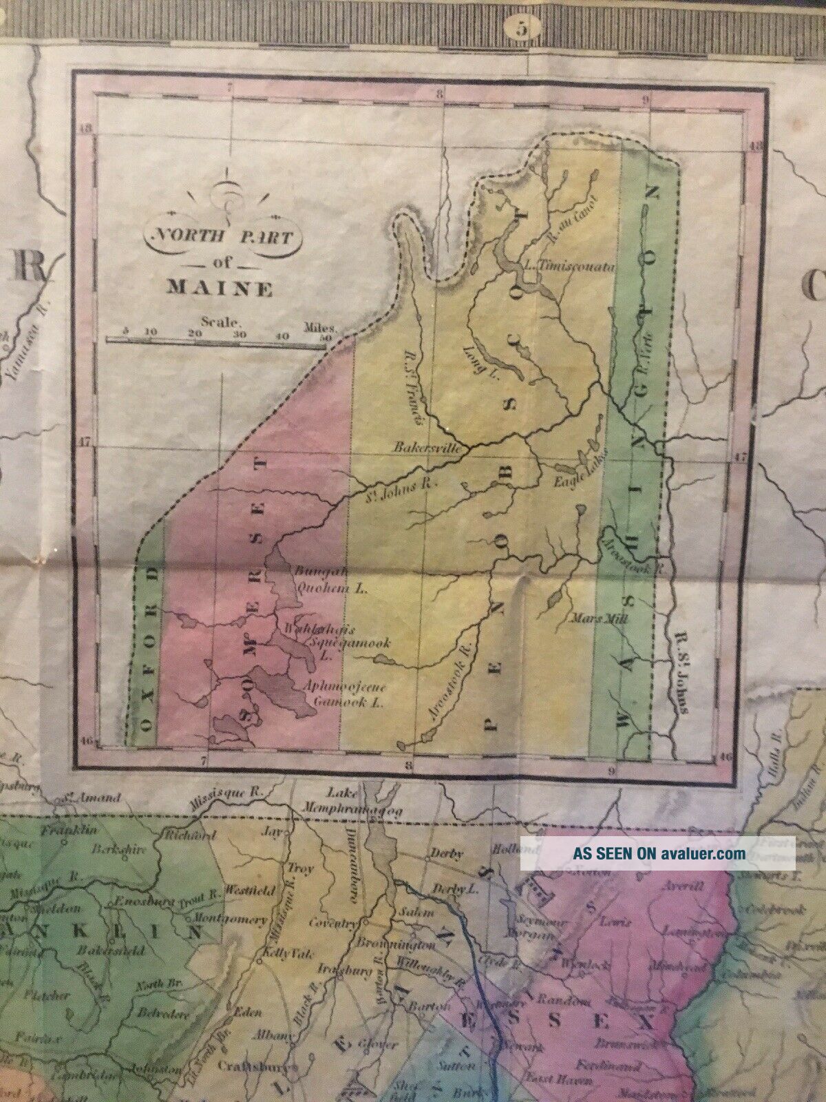
You're bidding on "Map of Maine, New Hampshire & Vermont - Compiled from the Latest Sources", published by S. Augustus Mitchell, Philadelphia, 1834. Mitchell (1792-1868) was a schoolteacher who grew so frustrated with the quality of resources for teaching geography that he relocated to Philadelphia and focused on producing high quality, accurate maps. Mitchell's atlases became the standard atlases of their day in the United States. One of his earliest products, though, were folding... maps oriented towards travelers - this is one of those maps - a nice, copper plate engraved map on bond paper, and beautifully hand-colored. Note that it would have originally folded up into a pocket-sized binding for protection and portability, but that does not appear to be present. 
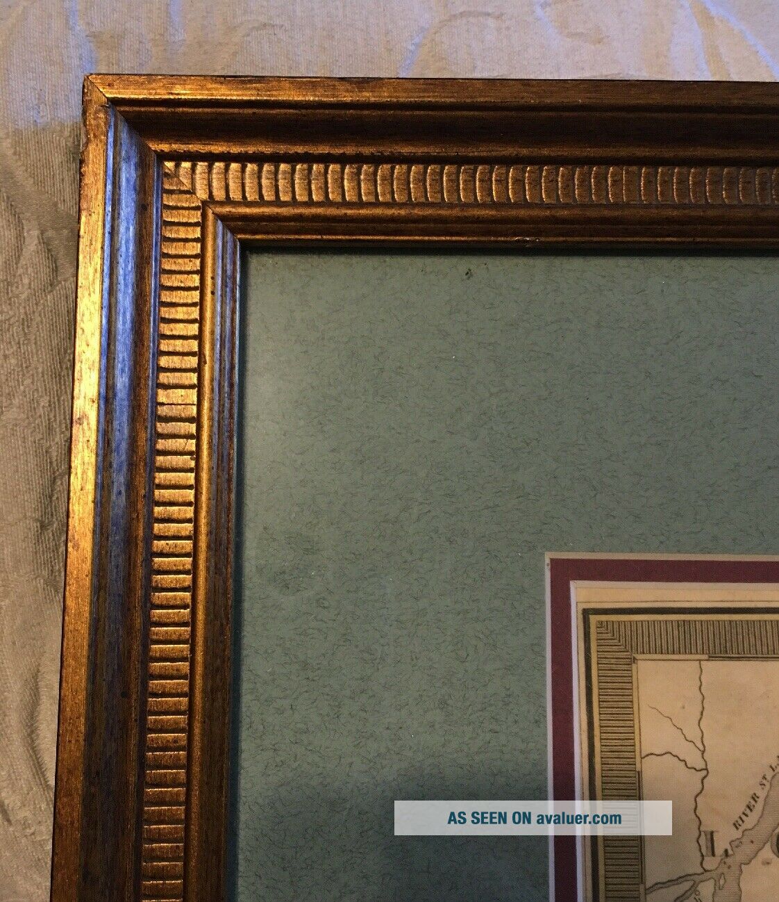
Map is beautifully framed and matted, though, and save for a couple of small spots, is clean and bright. Visible map is 21 1/2" X 17", total size in framing  is 28" X 24". Note that I have not examined outside of framing. Will consider shipping unframed upon request to reduce cost, but I imagine the cost to re-frame and mat would be considerably more than the ship cost as is. 
Please review photos carefully to make your own determination of overall condition and appeal, and don't hesitate to ask any questions prior to bidding - thanks for looking!


    Similar items


  • Rare Vintage 1970 Maine - Hampshire - Vermont Train Excursion Poster Sign

    Rare Vintage 1970 Maine - Hampshire - Vermont Train Excursion Poster Sign

  • Rare Vintage 1969 Maine - Hampshire - Vermont Train Excursion Poster Sign

    Rare Vintage 1969 Maine - Hampshire - Vermont Train Excursion Poster Sign

  • Rare Vintage 1974 Maine - Hampshire - Vermont Train Excursion Poster Sign

    Rare Vintage 1974 Maine - Hampshire - Vermont Train Excursion Poster Sign

  • Vintage 1853 Maine Hampshire Vermont Map Old Antique Atlas Map

    Vintage 1853 Maine Hampshire Vermont Map Old Antique Atlas Map

  • 1957 Maine Hampshire Vermont Road Map Mobil Oil Gas Socony Northern Eng

    1957 Maine Hampshire Vermont Road Map Mobil Oil Gas Socony Northern Eng

  • 1973 Bp Oil Road Map Maine Hampshire Vermont Concord Portland Burlington

    1973 Bp Oil Road Map Maine Hampshire Vermont Concord Portland Burlington

  • Maine Hampshire & Vermont 1866 Color Map 12 X 10 Color Map Mcnally

    Maine Hampshire & Vermont 1866 Color Map 12 X 10 Color Map Mcnally

  • Vintage 1962 Sinclair Oil Gas Maine Hampshire Vermont State Highway Road Map

    Vintage 1962 Sinclair Oil Gas Maine Hampshire Vermont State Highway Road Map


    • You might also like


    • 1860 Mitchell Hand Colored Map Colorado,  Nebraska & Kansas - Civil War Era

      1860 Mitchell Hand Colored Map Colorado, Nebraska & Kansas - Civil War Era

    • 18th Century French Map Of North America

      18th Century French Map Of North America

    • Las Vegas Nevada Vintage 1967 Us Geological Survey Quadrangle Map 4 Panels

      Las Vegas Nevada Vintage 1967 Us Geological Survey Quadrangle Map 4 Panels

    • Rare Antique 1845 Maps United States Exploring Expedition Book Antartica Hawaii

      Rare Antique 1845 Maps United States Exploring Expedition Book Antartica Hawaii

    • Vintage 1926 Map Hollywood From The Best Surveys Of The Time

      Vintage 1926 Map Hollywood From The Best Surveys Of The Time

    • American Continent (western Hemisphere) 1747 Bowen Antique Copper Engraved Map

      American Continent (western Hemisphere) 1747 Bowen Antique Copper Engraved Map

    • Gulf Coast Florida Texas United States 1705 De Fer Unusual Antique Engraved Map

      Gulf Coast Florida Texas United States 1705 De Fer Unusual Antique Engraved Map

    • California As Island United States 1700 De Fer Unusual First Edition Antique Map

      California As Island United States 1700 De Fer Unusual First Edition Antique Map

Avaluer          About Us          Privacy Policy          Contact Us          UP
© 2022, avaluer.net, Inc. or its affiliates